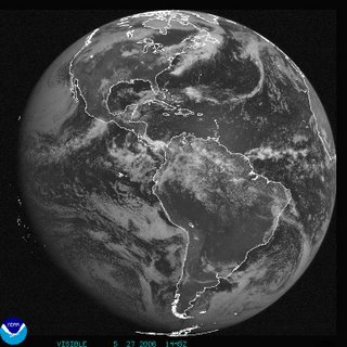
Saturday, May 27, 2006
First Pacific TD Forms
Monday, May 22, 2006
NOAA 2006 Tropical Season Predictions
Batten up the hatches, NOAA predicts a busy Hurricane Season .
13 to 16 Named Storms of at least Tropical Storm strength.
8 to 10 Hurricanes Categories I and II strength.
4 to 6 Major Hurricanes Categories III, IV, and/or V strength.
Compare this to last years record-breaking season:
28 Named Storms
15 Hurricanes
7 Major Hurricanes
May 21 to 27 is Hurricane Prepardness Week.....Don't say you weren't warned!
Monday, May 08, 2006
2006 Hurricane Season Cometh
In less than 3 weeks, the 2006 Hurricane Season will begin. Be sure you are prepared by having extra batteries for your flashlight and portable radios, along with food and water for about a week. Even in the mountains of western North Carolina, as last year taught us. I will be posting links in the sidebar for prepardness in the next couple of weeks.
Here are the names for the 2006 season:
Alberto, Beryl, Chris, Debby, Ernesto, Florence, Gordon, Helene, Isaac, Joyce, Kirk, Leslie, Michael, Nadine, Oscar, Patty, Rafael, Sandy, Tonu, Valerie, William, an, if needed, Alpha, Beta, gamma, Delta, and so on. Lets hope not.
Thw eweather for WNC should include some rain showers moving in Wednesday and Thursday, with the rest of the week relatively rain-free.
Tuesday, May 02, 2006
Primary Day Weather Forecast for WNC
Hazardous Weather Outlook
HAZARDOUS WEATHER OUTLOOK
NATIONAL WEATHER SERVICE GREENVILLE-SPARTANBURG SC
429 AM EDT TUE MAY 2 2006
GAZ010-017-018-026-028-029-NCZ033>037-048>059-062>072-082-
SCZ001>014-019-030830-
RABUN-HABERSHAM-STEPHENS-FRANKLIN-HART-ELBERT-AVERY-CALDWELL-
ALEXANDER-IREDELL-DAVIE-MADISON-YANCEY-MITCHELL-SWAIN-HAYWOOD-
BUNCOMBE-MCDOWELL-BURKE-CATAWBA-ROWAN-GRAHAM-NORTHERN JACKSON-
MACON-SOUTHERN JACKSON-TRANSYLVANIA-HENDERSON-POLK-RUTHERFORD-
CLEVELAND-LINCOLN-GASTON-MECKLENBURG-CABARRUS-UNION NC-
OCONEE MOUNTAINS-PICKENS MOUNTAINS-GREENVILLE MOUNTAINS-
GREATER OCONEE-GREATER PICKENS-GREATER GREENVILLE-SPARTANBURG-
CHEROKEE-YORK-ANDERSON-ABBEVILLE-LAURENS-UNION SC-CHESTER-
GREENWOOD-
429 AM EDT TUE MAY 2 2006
THIS HAZARDOUS WEATHER OUTLOOK IS FOR PORTIONS OF NORTHEAST
GEORGIA...PIEDMONT NORTH CAROLINA...WESTERN NORTH CAROLINA AND
UPSTATE SOUTH CAROLINA.
.DAY ONE...TODAY AND TONIGHT
STRONG THUNDERSTORMS ARE EXPECTED TO DEVELOP ACROSS EASTERN
TENNESSEE BY THIS AFTERNOON. THESE THUNDERSTORMS WILL MOVE EAST
AND WEAKEN AS THEY REACH THE WESTERN SLOPES OF THE SOUTHERN
APPALACHIANS. AN ISOLATED SEVERE THUNDERSTORM CANNOT BE COMPLETELY
RULED OUT IN THE NORTH CAROLINA MOUNTAINS...BUT THE MAIN HAZARDS
WILL LIKELY BE LIGHTNING AND BRIEFLY GUSTY WINDS LATE THIS AFTERNOON.
.DAYS TWO THROUGH SEVEN...WEDNESDAY THROUGH MONDAY
ADDITIONAL SCATTERED THUNDERSTORMS ARE EXPECTED TO DEVELOP FROM
THURSDAY AFTERNOON THROUGH SATURDAY...MAINLY AFFECTING THE NORTH
CAROLINA MOUNTAINS.
.SPOTTER INFORMATION STATEMENT...
SPOTTER ACTIVATION IS NOT EXPECTED TODAY.
$$
